We travelled north in the interior to go to a couple of lakes and streams where Barre had collected pondweeds in 1997. It was hoped that plants could be collected for DNA analysis. The road north brought us through rolling hills and grasslands filled with hundreds of Merino sheep.
Field of Marino sheep
Opum poppy field
Local farmers are also in the lucrative business of legally growing Opium poppies for the manufacture of morphine. Fields were common with plants in all stages of growth.
Along the roadside we encounterd an echnida (spiny ant eater), We got out of the car to photograph him when he curled up in a ball, hiding his head and not moving.
Ross Main Street
We stopped at Oatlands where Barre hunted in Lake Dulverton for a pondweed previously collected at this site. This was the only site Barre where Barre would be successful. The waters were high and it was apparently a little too early for much development of aquatic plants. We travelled on to the charming town of Ross. The town is considered the finest 19th century village in Australia. Originally it was a 'female factory' where incarcerated woman worked. One of the most beautiful old bridges constructed by convict labor was built here.
One of the four Ross churches
We spent the night at the Ross Motel. In the morning we had breakfast at the local bakery and then travelled over the highlands from Campbell Town to Bicheno. A stop was made at Lake Leake to look for plants to no avail. The water was too high. We were now encountering our first rain.
Shoreline at Bicheno
We travelled north along the shore to Bicheno, had tea and went down to the shoreline. The rocks were quite colorful with a red lichen occuring just above tide level. Our next destination was Freycinet National Park which is located on a long narrow peninsula.
Coles Bay, Freycinet Peninsula
The weather when we arrived at the Park was starting to deteriorate with on and off showers. We had lunch at the Freycinet Lodge and then decided what we would like to do while there. The initial plan was to take about an hour round trip hike to a viewpoint for Wineglass Bay, a long curving white-sand beach. But, it started to rain, so we drove around to various viewpoints. At Cape Tourville, the showers subsided so we had a chance to walk the trail up to the lighthouse.
Cape Tourville lighthouse
View south from Cape Tourville to Wineglass Bay is distance
Marion and Betty along footpath to lighthouse
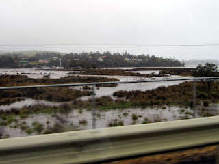
Flooded field
Swollen River
Spiky Bridge
South of Swansea we stopped to take a picture of Spiky Bridge. The bridge was built by convicts in 1843. One of the legends as to why the rocks were laid sharp end up along the top, like spikes, was to keep cows from "jumping" off the bridge.
Burned countryside heading south onto Tasman Peninsula
We continued on south to the Tasman Peninsula. We travelled though miles of burned forest. The town of Dunalley was hard hit in this January 2013 fire.
Tesselted Pavement
Closeup of Tesselated Payment
We stopped to view the Tesselated Pavement at Eaglehawk. The strange rectangular configurations of the sedimentary rocks (sandstone) forms the pavement along the shoreline. These are formed due to the combination of erosion and salt deposites in the cracks. We had lunch across the street at a Best Western Lodge. We decided to book the night there. The weather clearned for the rest of the afternnon which was a pleasant surprise. Then we were off to view three more local attactions along Pirates Bay: the blowhole, Tasmans Arch, and the Devils Kitchen.
water exiting the blowhole
looking through the blowhole to the other side
The blowhole was formed by a hole worn through the cliff to the open ocean. As the waves crashed into the wall, the water was forced through the opening to a large "bowl" on the otherside. Many of the larger waves were quite violent.
Tasmans Arch
The arch connected directly to the sea. I would guess it is approximately 75 ft. high.
Pounding surf at Devils Kitchen
Devils Kitchen
Devils kitchen is a deep chasm formed by the waves entering a narrow passage. Photos do not do it justice. It is about 200 ft. deep. Our last srop was the Port Arthur Historic site at the south end of the Tasman Peninsula. The Port Arthur site was initially utilized as a timber camp utilizing convict labor. Then in 1833 it was convertd to a punishment station for repeat offenders from all Australian colonies. The site includes the penitentiary, a community for the military where they and their families lived in stark contrast to the prisoners.
Penitentiary (1857)
Guard Tower (1835)
Church (1837)
Large Eucalyptus by Commandant's home
evening view from motel at Pirate's Bay
Tasmania is the only state where the Tasmanian Devil occurs. Today it is an endangered species due to a fatal cancer. The northwest corner odf the state and the Tasman Peninsula are the only two areas that are free from the cancer. We saw many Tasmanian Devil road signs, but no devils. The morning of our departure it was raining again. We arrived back in Sydney around 1:30 PM. We had a great trip!


.jpg)
.jpg)
.jpg)


No comments:
Post a Comment